Generation 1 Maps
The following maps were initially compiled in 1997 on paper, and then digitized into ArcGIS. They were finally published in 2007. Click on each thumbnail to get a larger image. Shapefiles are available on request for research purposes.
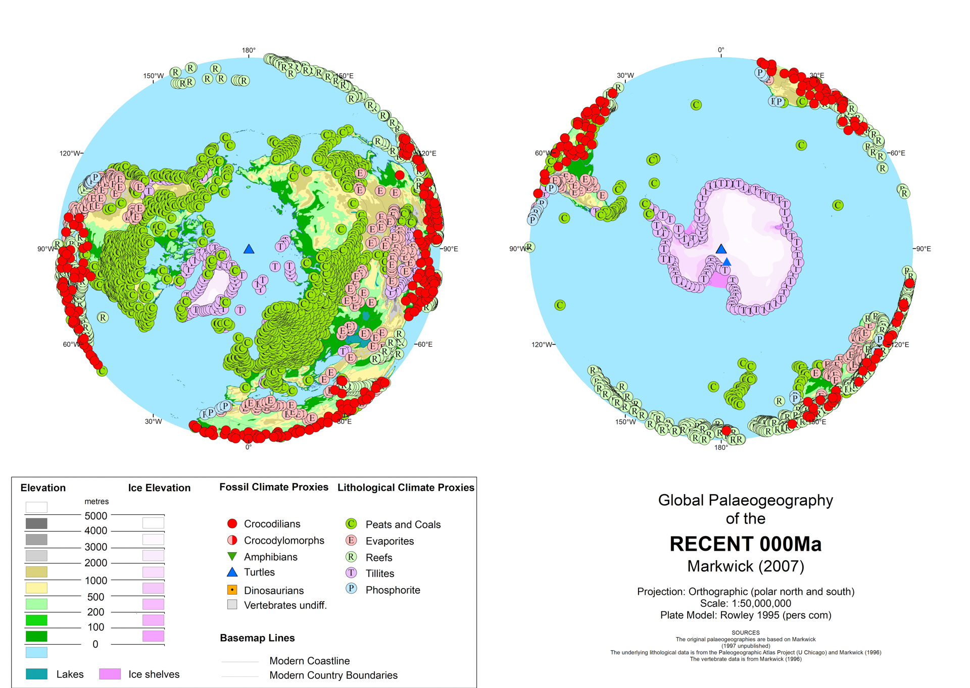
Present Day
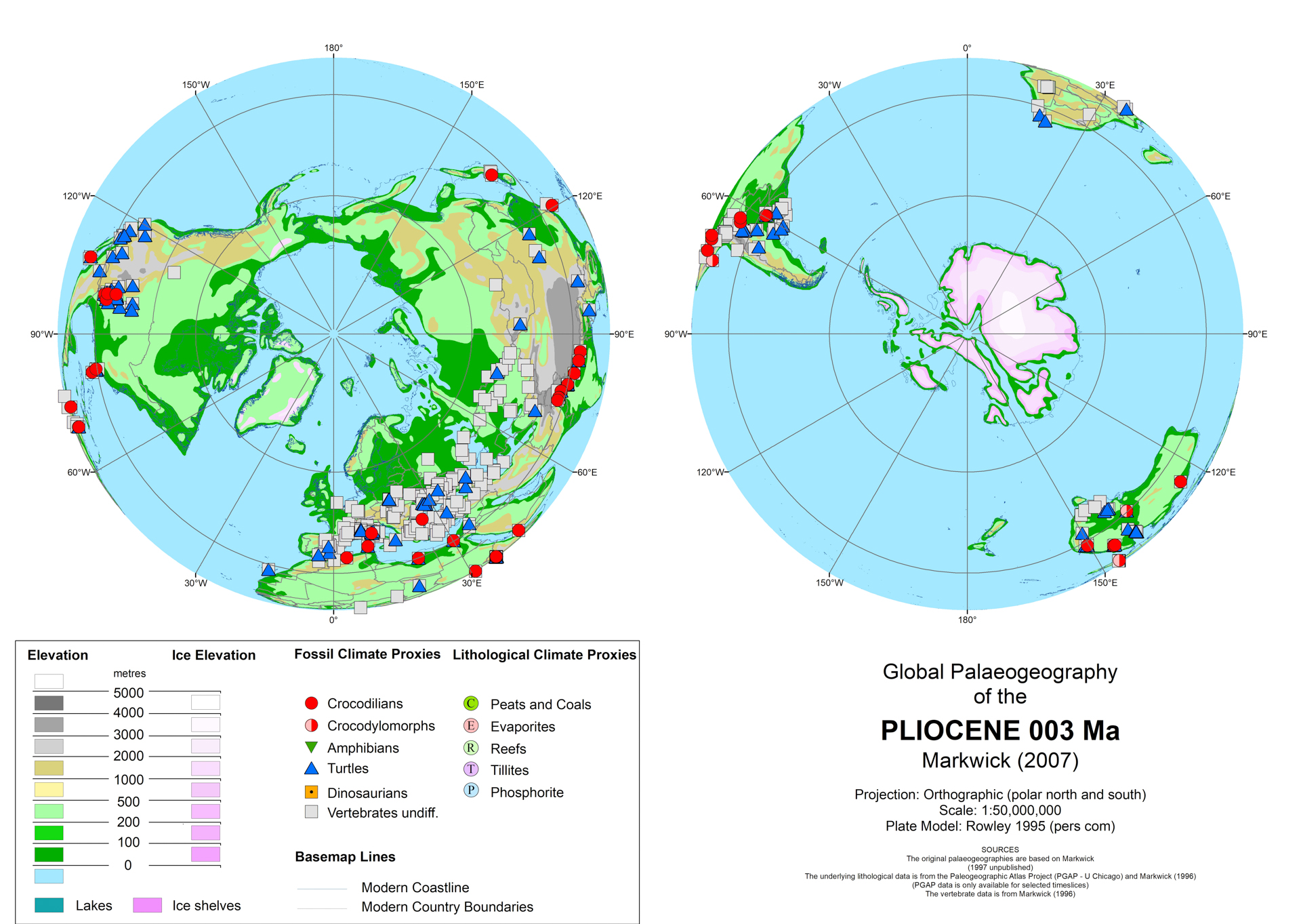
Pliocene

Early Miocene

Late Eocene
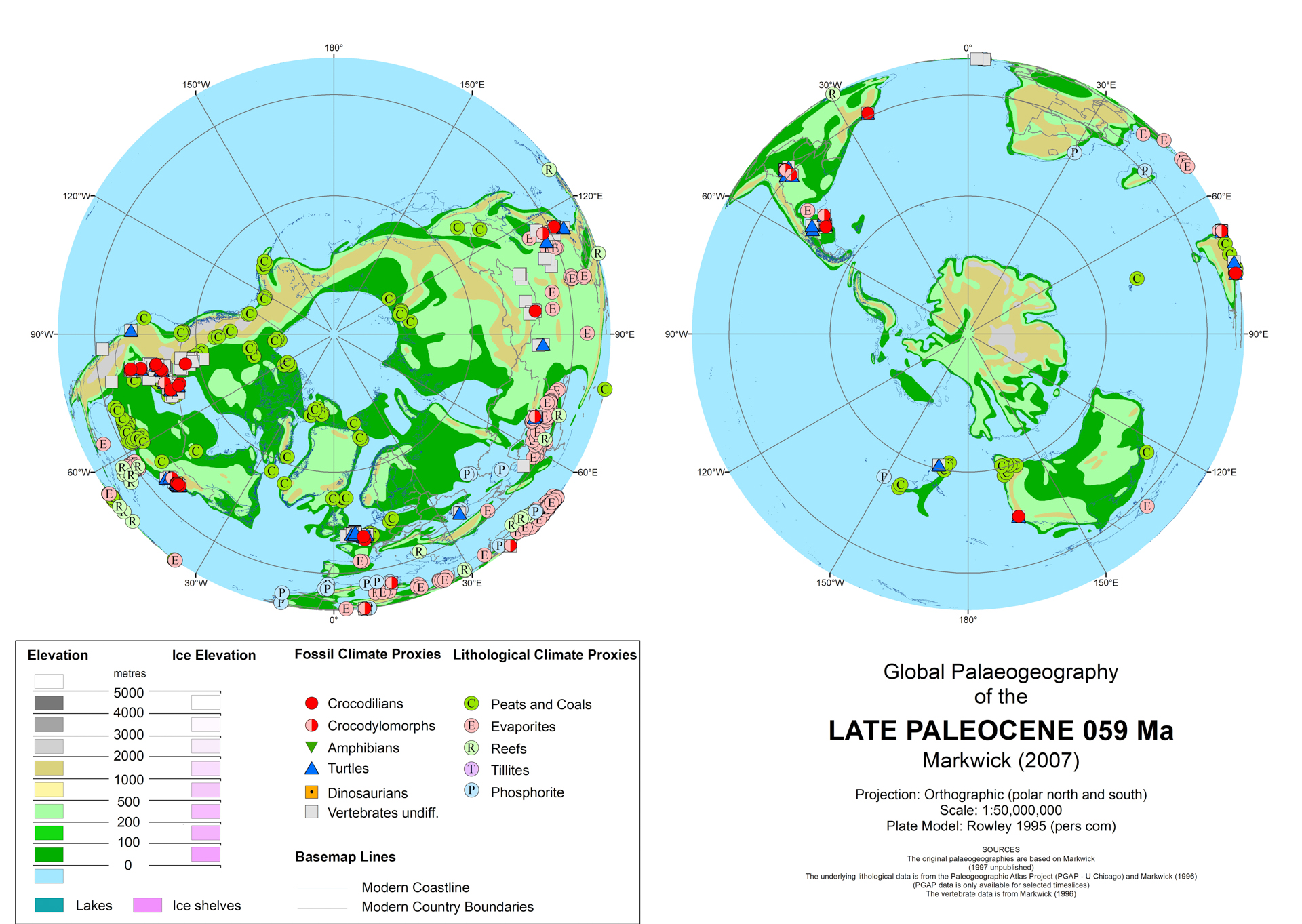
Late Paleocene
|
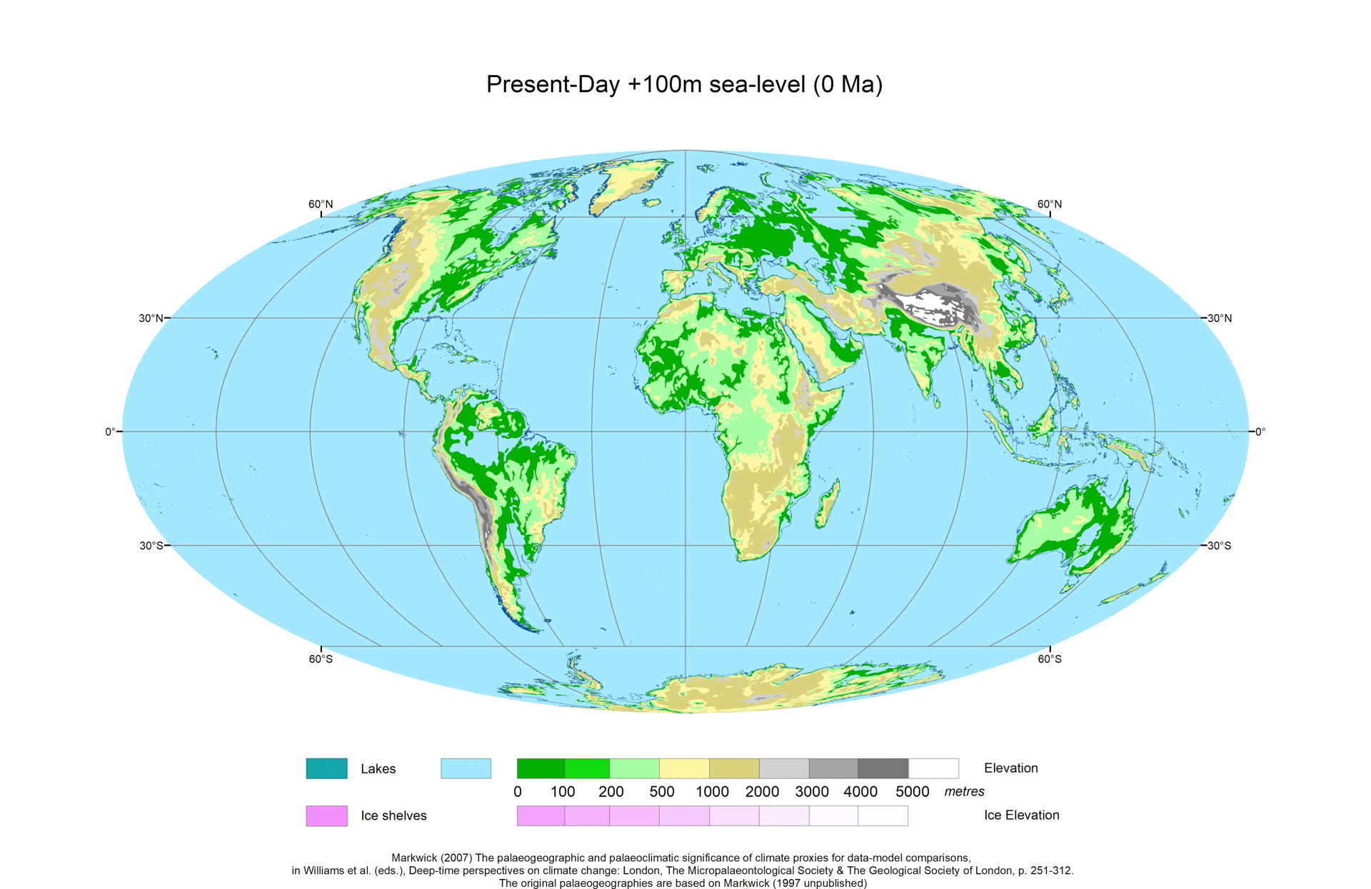
Present Day +100m Sea level

Late Miocene
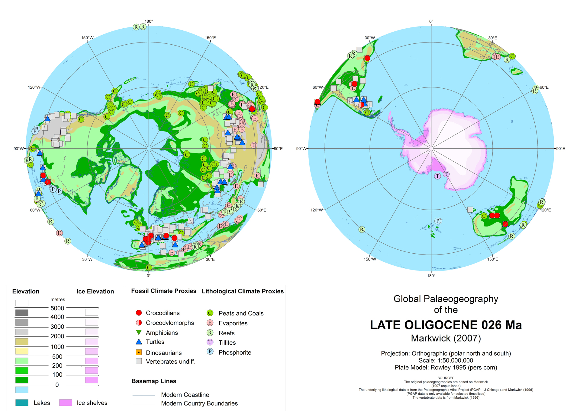
Late Oligocene
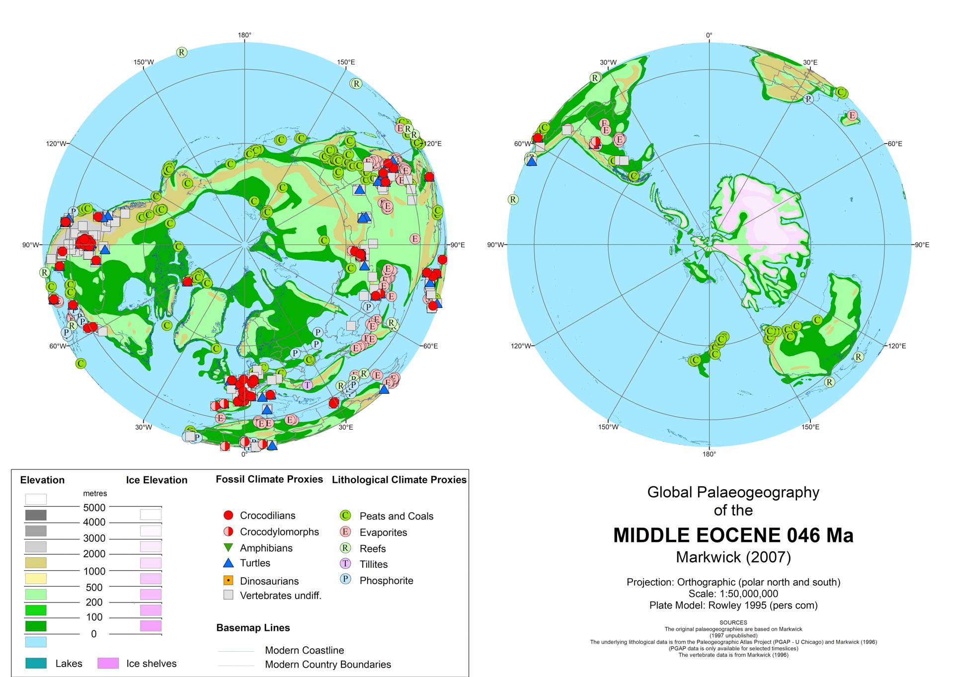
Middle Eocene
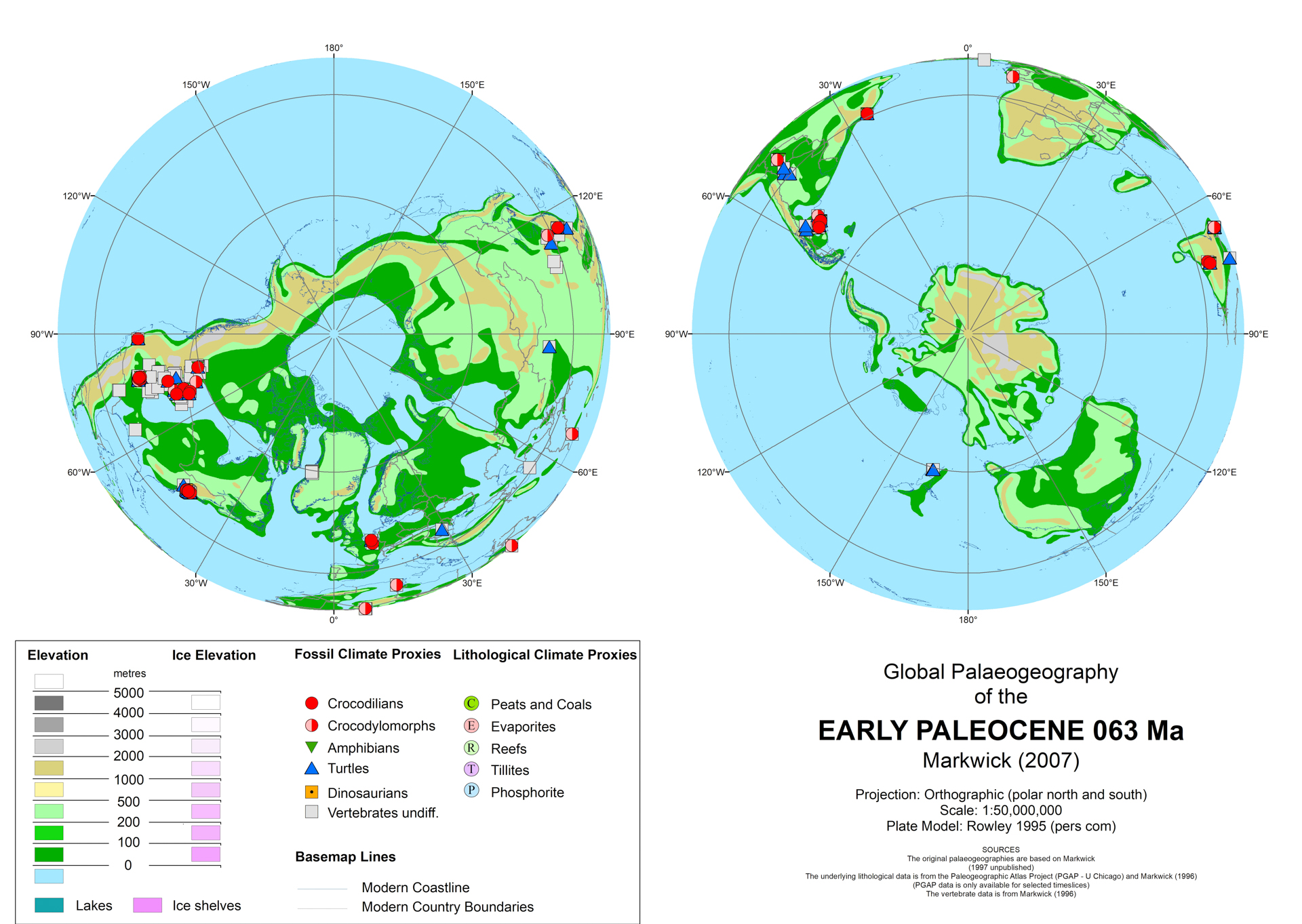
Early Paleocene
|
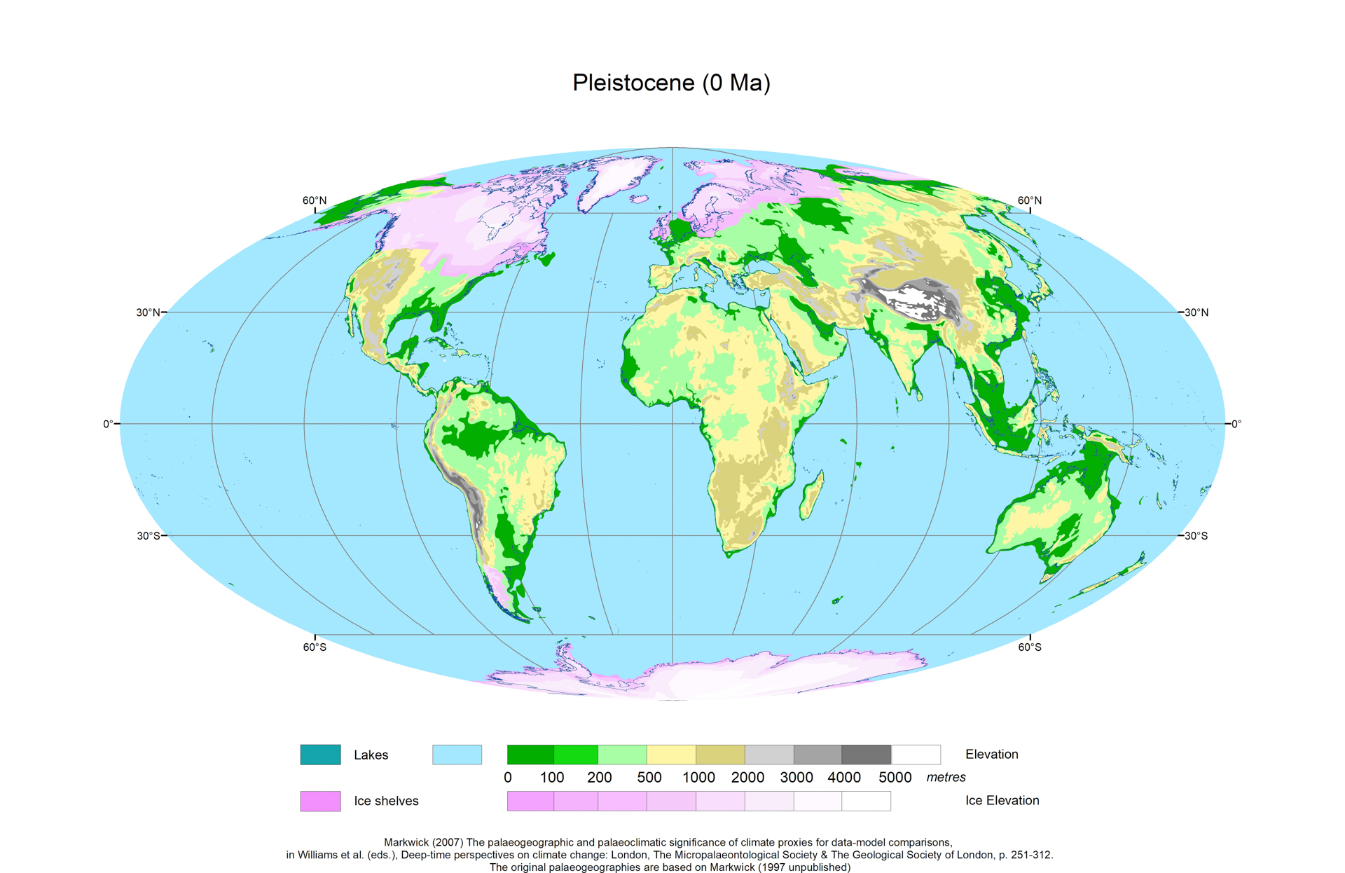
Pleistocene (LGM)
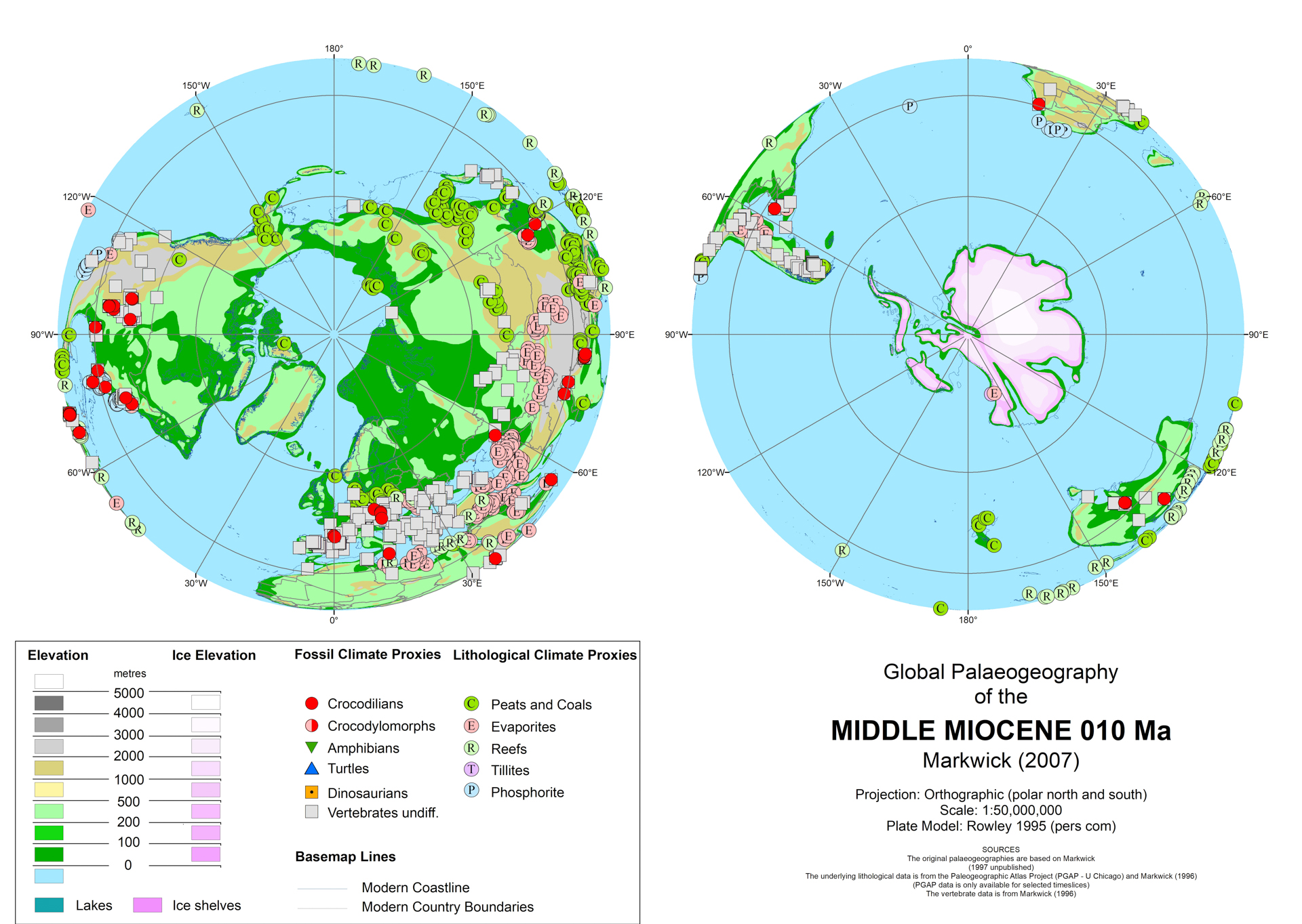
Middle Miocene

Early Oligocene
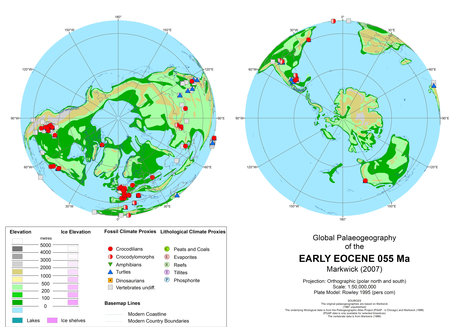
Early Eocene
|
Generation 1 revised Maps
Four timeslice maps were updated for specific coupled ocean-atmosphere modelling, though only the Maastrichtian has been published (Markwick & Valdes, 2004).
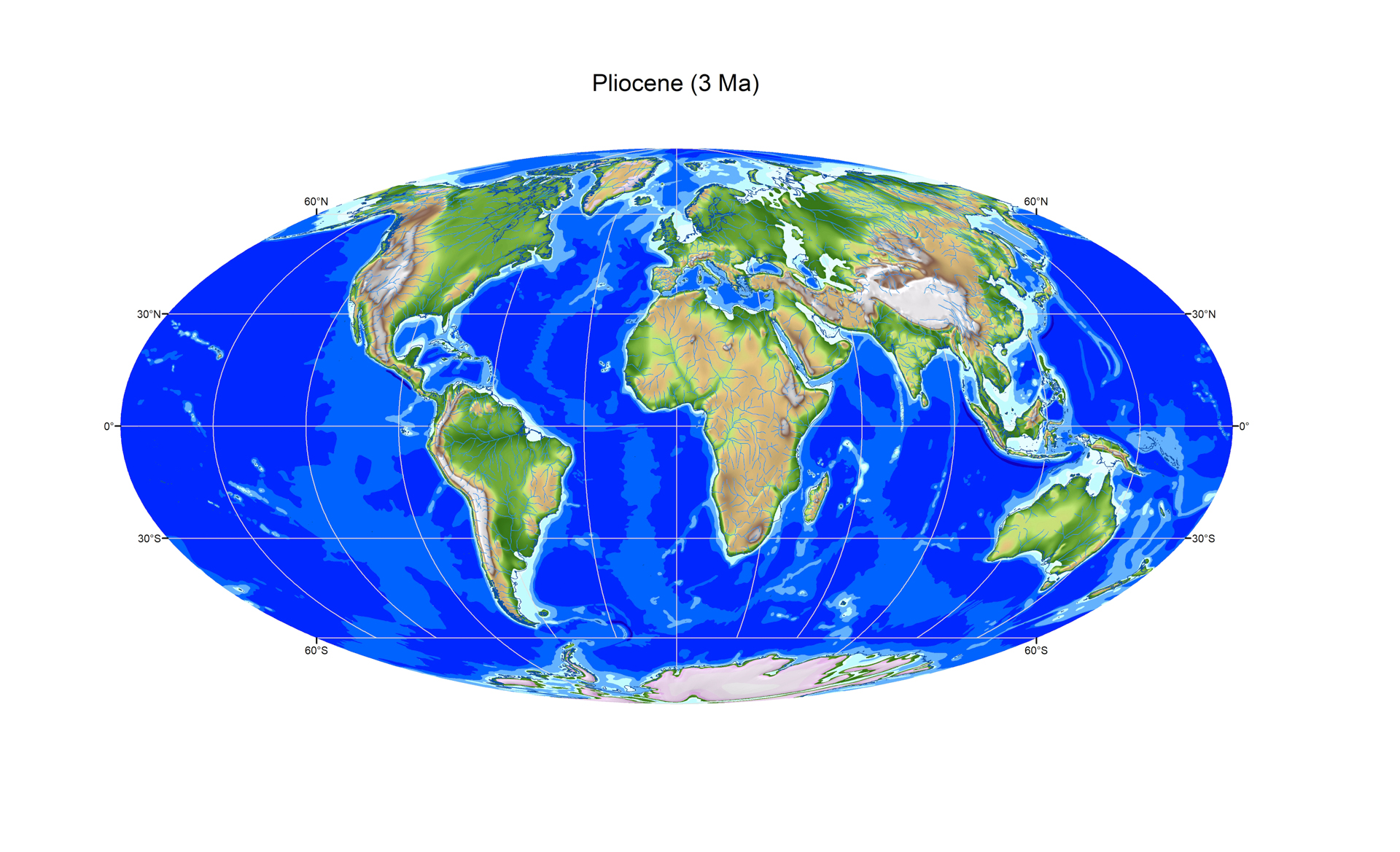
Pliocene (3 Ma)
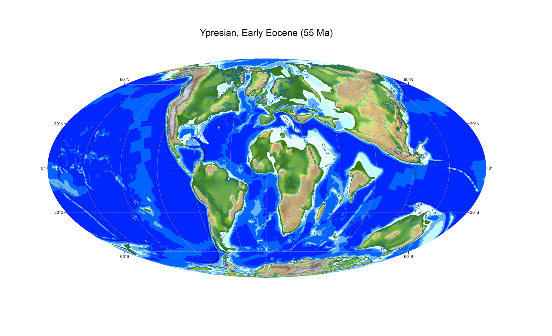
Ypresian, Early Eocene (55 Ma)
|
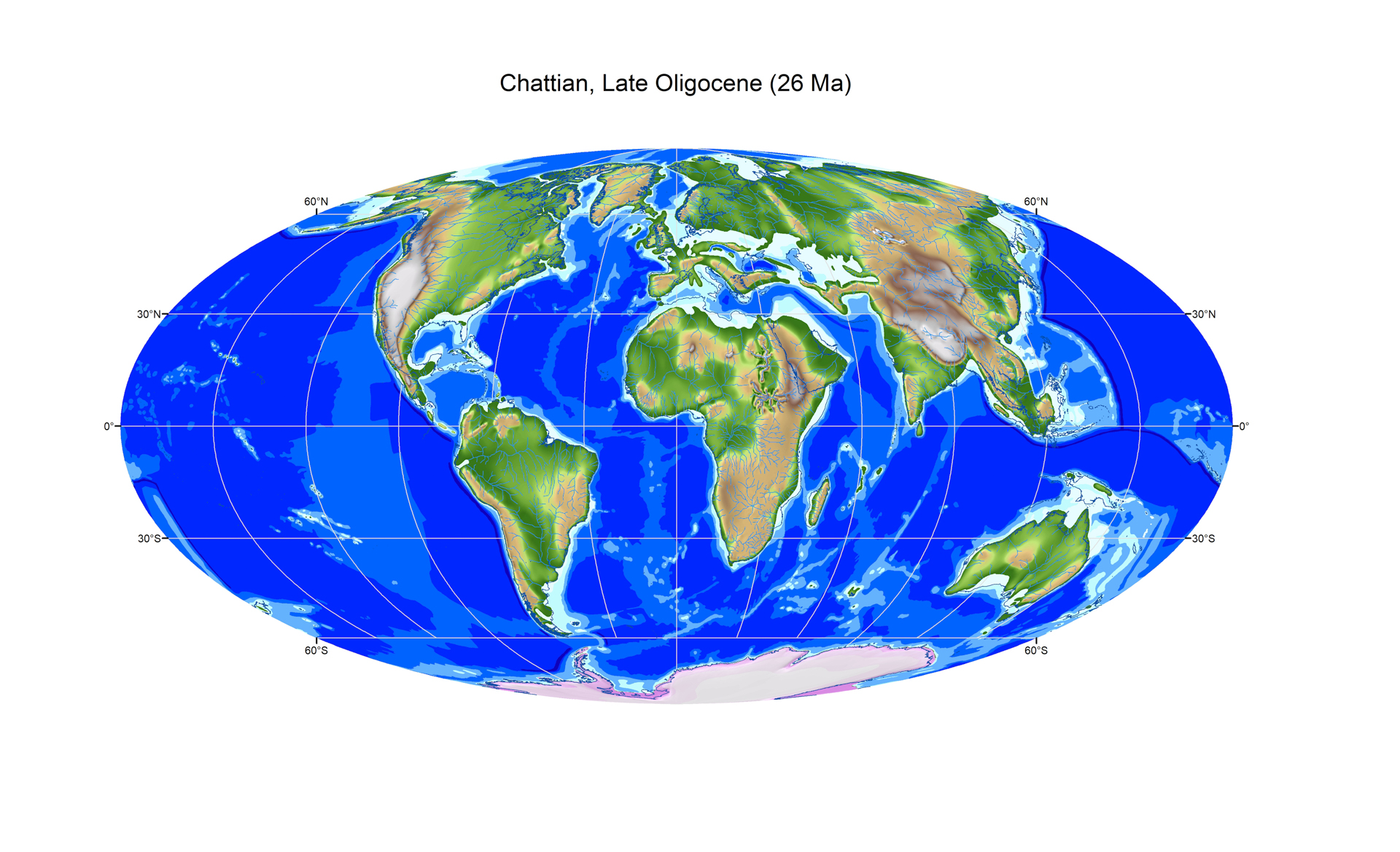
Chattian, Late Oligocene (26 Ma)

Maastrichtian, latest Cretaceous (70 Ma)
|