What is palaeoclimatology?
The field of palaeoclimatology examines the history of climate, it's changing distribution and the dynamics responsible. It also provides important information for understanding palaeobiogeography, vegetation history, weathering, erosion and drainage patterns.
The study of palaeoclimate has a long history dating back to at least the early part of the nineteenth century. Lyell devoted three chapters to the subject in his "Principles of Geology" and for 30 years or so it dominated the interest of the foremost geologists of the day, not least because the large changes in climate were readily apparent and provided the most spectacular evidence of a dynamic world. Arguments about the warmth of the early Tertiary and Mesozoic are not recent discoveries.
The study of palaeoclimate has a long history dating back to at least the early part of the nineteenth century. Lyell devoted three chapters to the subject in his "Principles of Geology" and for 30 years or so it dominated the interest of the foremost geologists of the day, not least because the large changes in climate were readily apparent and provided the most spectacular evidence of a dynamic world. Arguments about the warmth of the early Tertiary and Mesozoic are not recent discoveries.
My research interests
My palaeoclimatology research is currently focussed on two main areas:
- the qualification and quantification of climatic interpretations derived from climate proxies and how these can be used to critically evaluate the results of climate modelling experiments (Markwick, P.J., et al., 1999);
- the application of climate model results to examine other issues in geology, such as palaeo-biodiversity, palaeo-biogeography and palaeo-landscape evolution, and also applied to oil, gas and minerals exploration .
This work goes back over 25 years to my PhD. The climate modelling work is being done in collaboration with research groups around the world, but the longest research relationship is with Professor Paul Valdes (University of Bristol). These models are used to examine the dynamics of palaeoclimate (the process), but they do not generate data in themselves; they are hypotheses to be tested against observations, which for palaeoclimate are represented by the geological record, and only the geological record. By using the geological data to map the spatial distribution of palaeoclimate (the pattern), comparison with model results is greatly facililtated.
The goal is to seek convergence between geological data and model results--since these models are also instrumental in predicting the potential direction and nature of future climates, whether naturally or anthropogenically induced, studies of the climate of the geological past have a direct application to present concerns.
The goal is to seek convergence between geological data and model results--since these models are also instrumental in predicting the potential direction and nature of future climates, whether naturally or anthropogenically induced, studies of the climate of the geological past have a direct application to present concerns.
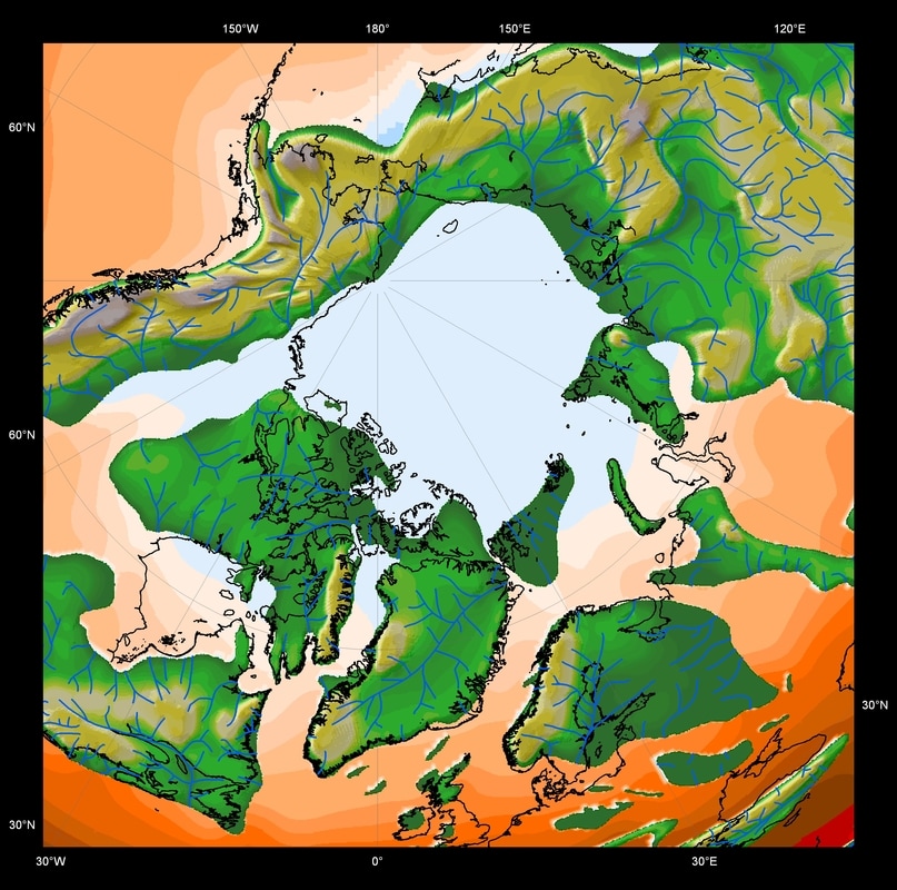
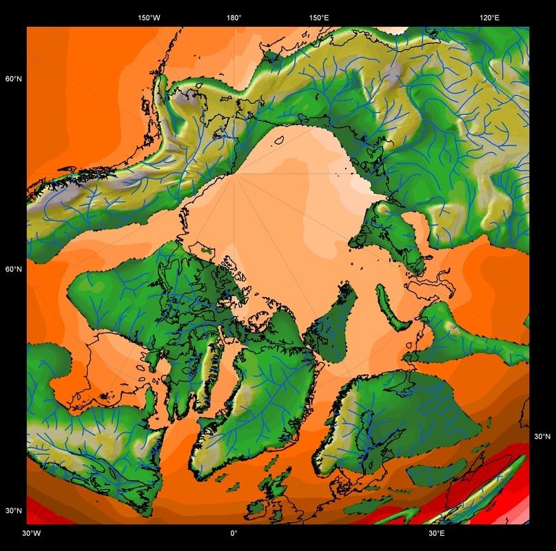
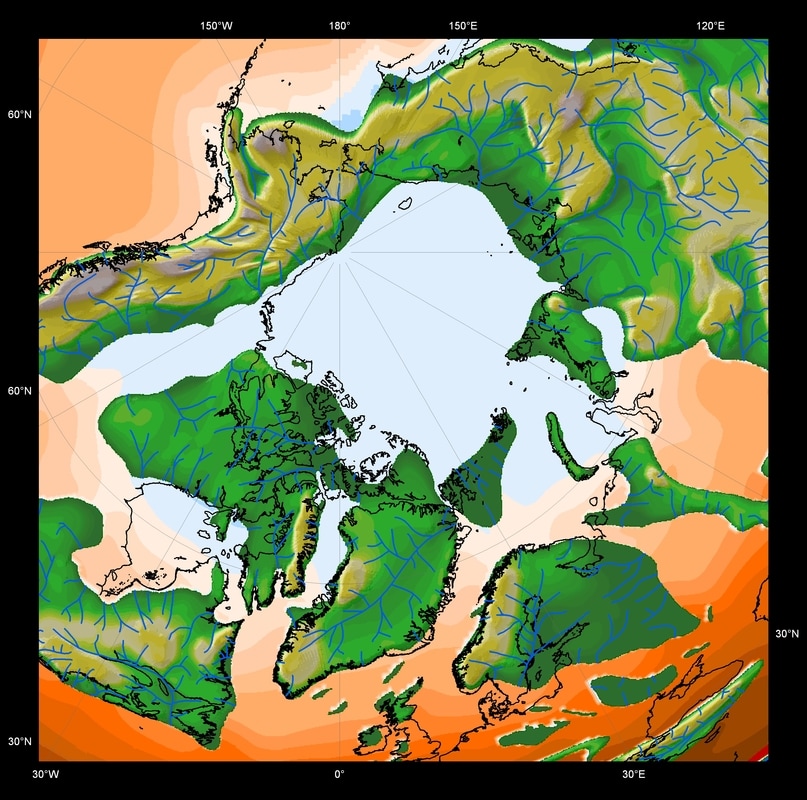
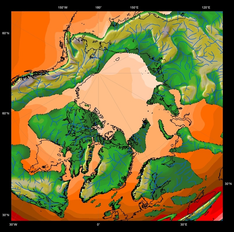
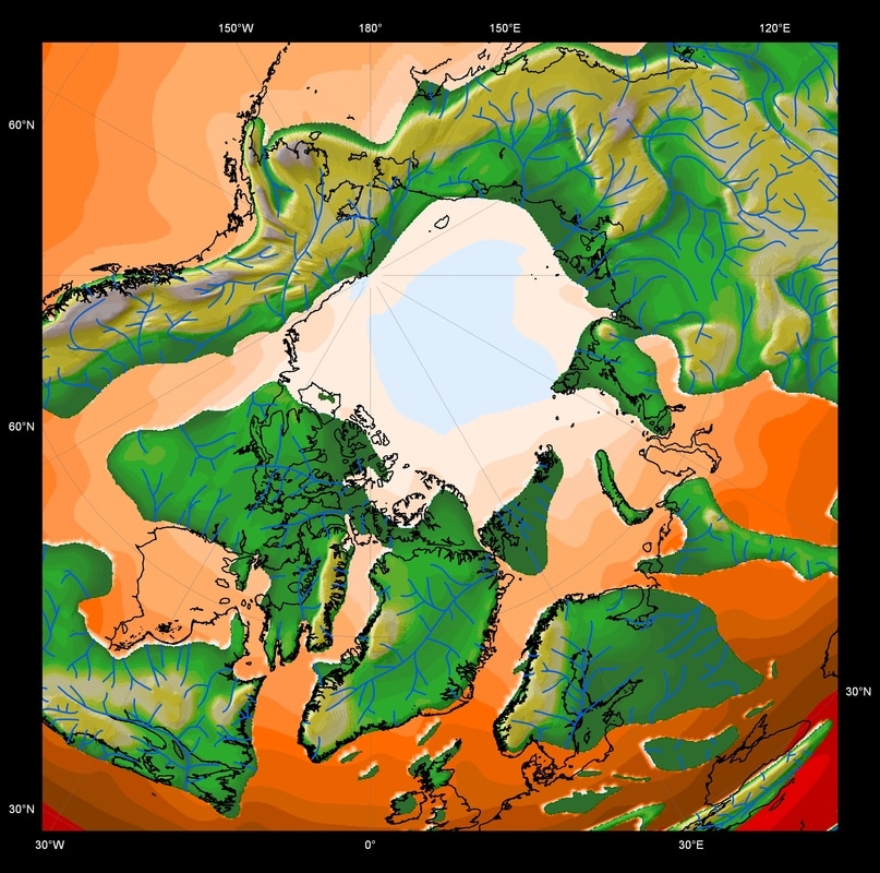
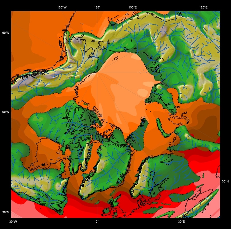
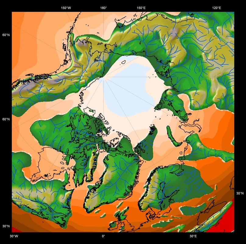
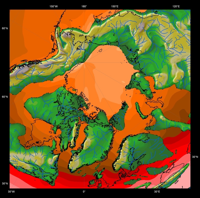
ABOVE: Modelled sea surface temperature (SST) for the Maastrichtian (unpublished) showing the effects of changing atmospheric carbon dioxide concentrations. Top are the seasonal temperatures for 2 x -pre-industrial. Bottom figures show the seasonal temperatures for 4 x pre-Industrial CO2.
It is important to appreciate that the geological record is not an impartial witness of the past. Consequently, much of my research has sought to assess and mitigate the potential impact of biases on palaeoclimatic interpretations derived from geologic data; for instance, qualifying absences of climate proxies, due to taphonomic or collection biases, using control groups. This has had practical applications in the design of databases, especially with the advent of Geographic Information Systems (Markwick and Lupia, 2002)
The integration of detailed GIS-based global palaeogeographies (especially as Digital Elevation Models, DEMs), with the latest coupled ocean-atmosphere models, and well constrained geological datasets with which to valid model experiments has major practical applications for better understanding the Earth System. This is the direction of my current independent research and collaborations.
The integration of detailed GIS-based global palaeogeographies (especially as Digital Elevation Models, DEMs), with the latest coupled ocean-atmosphere models, and well constrained geological datasets with which to valid model experiments has major practical applications for better understanding the Earth System. This is the direction of my current independent research and collaborations.
Climate Proxies
Geological climate proxies can be any geological phenomena that provides information about the contemporary climate. They include fossil faunas and floras, sediments such as soils and evaporites, geochemistry (e.g. oxygen isotopes), stratigraphic architecture (e.g. cyclicity). For any climate proxy to be of use it's position in climate space (the multidimensional space delimited by climate variables) must be determined. With the advent of more robust climate models (GCMs) the need for quantitative descriptions of climate proxies has become essential, since descriptions such as "arid" or "wet" provide only the most basic qualitative information.
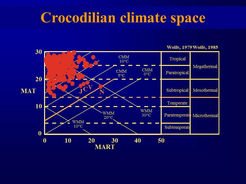
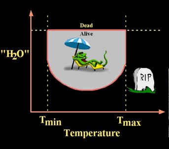
Like petrological phase space, the boundaries in climate space for climate proxies can be determined by experiment. For faunal and floral proxies such experiments are rarely pursued since any move outside of their climate space results, by definition, in death. In my thesis and the papers that followed (Markwick, 1996, 1998) I relied on a different approach, which used the modern distribution of each taxonomic group or assemblage to define at least part of the climate space. The assumption was that the distribution of these taxa was more or less in equilibrium with their environment and that the occurrence of a taxon did represent the presence of a viable, re-producing population. By intersecting these distributions with modern climate information (the last 30 years at least), I could define a basic climate space for each group.
However, while this technique was able to define where a taxon could exist (it's presence), the opposite was not necessarily true, since an absence today could be due to lack of other environmental factors (for crocodilians this was often standing water), or a historical biogeographical artifact (e.g. the absence of alligatorids from Africa and Australia). Thus absences had to be investigated, but given the environmental datasets available this was possible (today it is even easier using GIS). Through this process, together with reference to what direct biological observations had been made, a climate space could be constructed (with caveats).
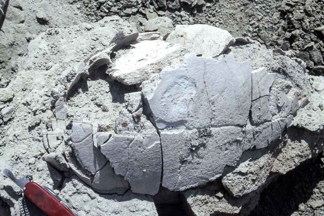
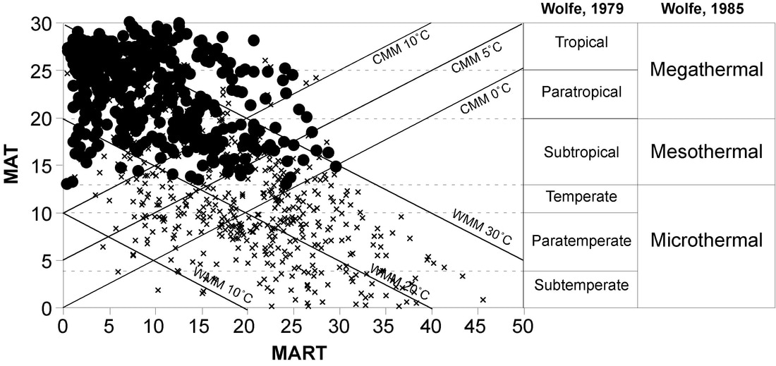
ABOVE: The climate space (temperature only) occupied by the giant tortoise Geochelone (Markwick, 1996: PhD thesis; Markwick, 2007).
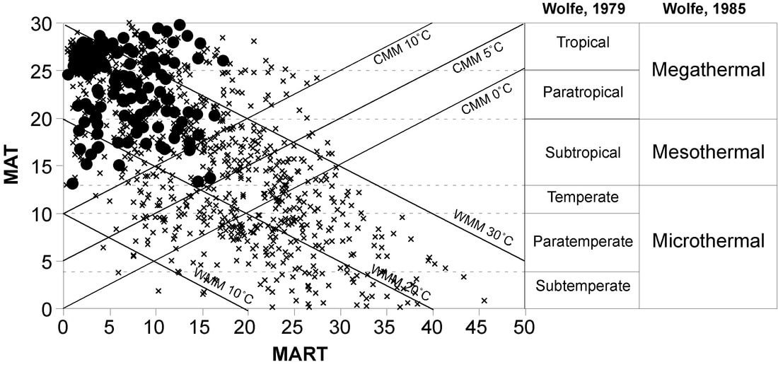
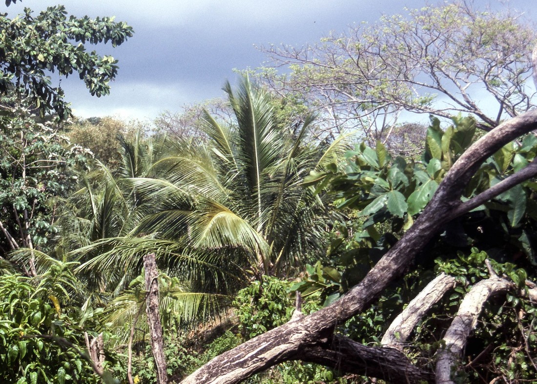
ABOVE: The climate space (temperature only) occupied by palms (Markwick, 1996: PhD thesis; Markwick, 2007).
There are a wealth of different geological climate proxies available, of lesser or greater significance. Other proxies include phosphorites, evaporites, 'red-beds', peats and coals, dune beded sandstones. Climate interpretations from all of these have to be treated with some care since no proxy is totally without caveats!
The key is to use multiple climate proxies.
The goal is to seek convergence between geological data and model results--since these models are also instrumental in predicting the potential direction and nature of future climates, whether naturally or anthropogenically induced, studies of the climate of the geological past have a direct application to present concerns.
Boundary conditions
Climate models require explicit representations of the Earth's surface. Back in 1997 this necessitated the development of a comprehensive set of Cretaceous-Tertiary palaeogeographies (Markwick et al., 2000), of which the Maastrichtian (based partly on work done by the Paleogeographic Alas Project at The University of Chicago) was the most complete (Markwick, 2001; Markwick & Valdes, 2004), and includes detailed bathymetries and palaeo-drainage systems, so essential for the latest coupled ocean-atmosphere experiments being run. Results for the Early Eocene, Miocene and Pliocene were then added through research with other academic partners.
|
Copyright © 2017-2021 Paul Markwick
|
E-mail: paulmarkwick@me.com
|
