Generation 1 Maps
The following maps were initially compiled in 1997 on paper, and then digitized into ArcGIS. They were finally published in 2007. Click on each thumbnail to get a larger image. Shapefiles are available on request for research purposes.
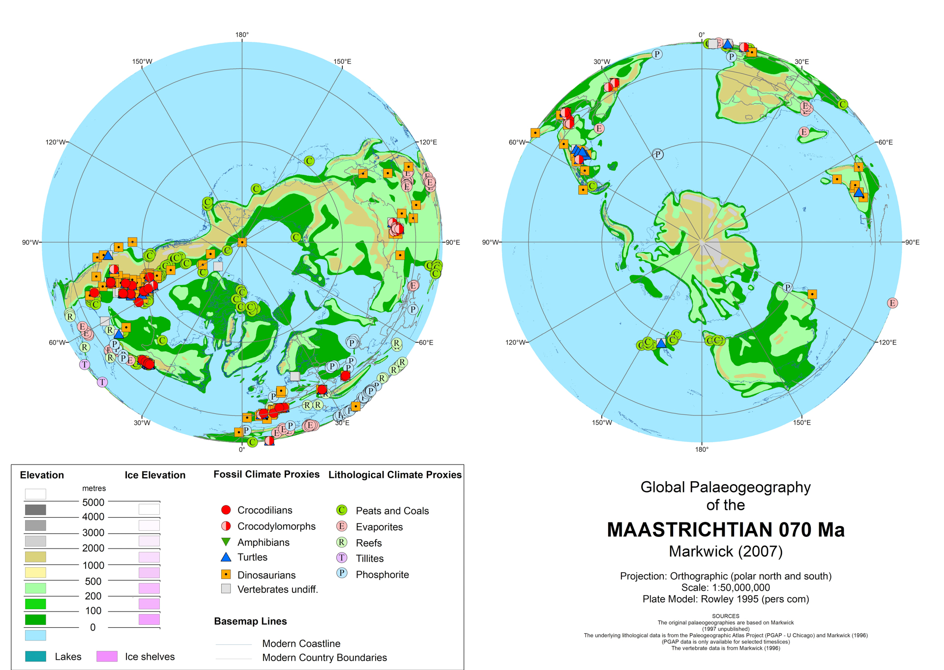
Maastrichtian

Coniacian

Albian
|

Campanian
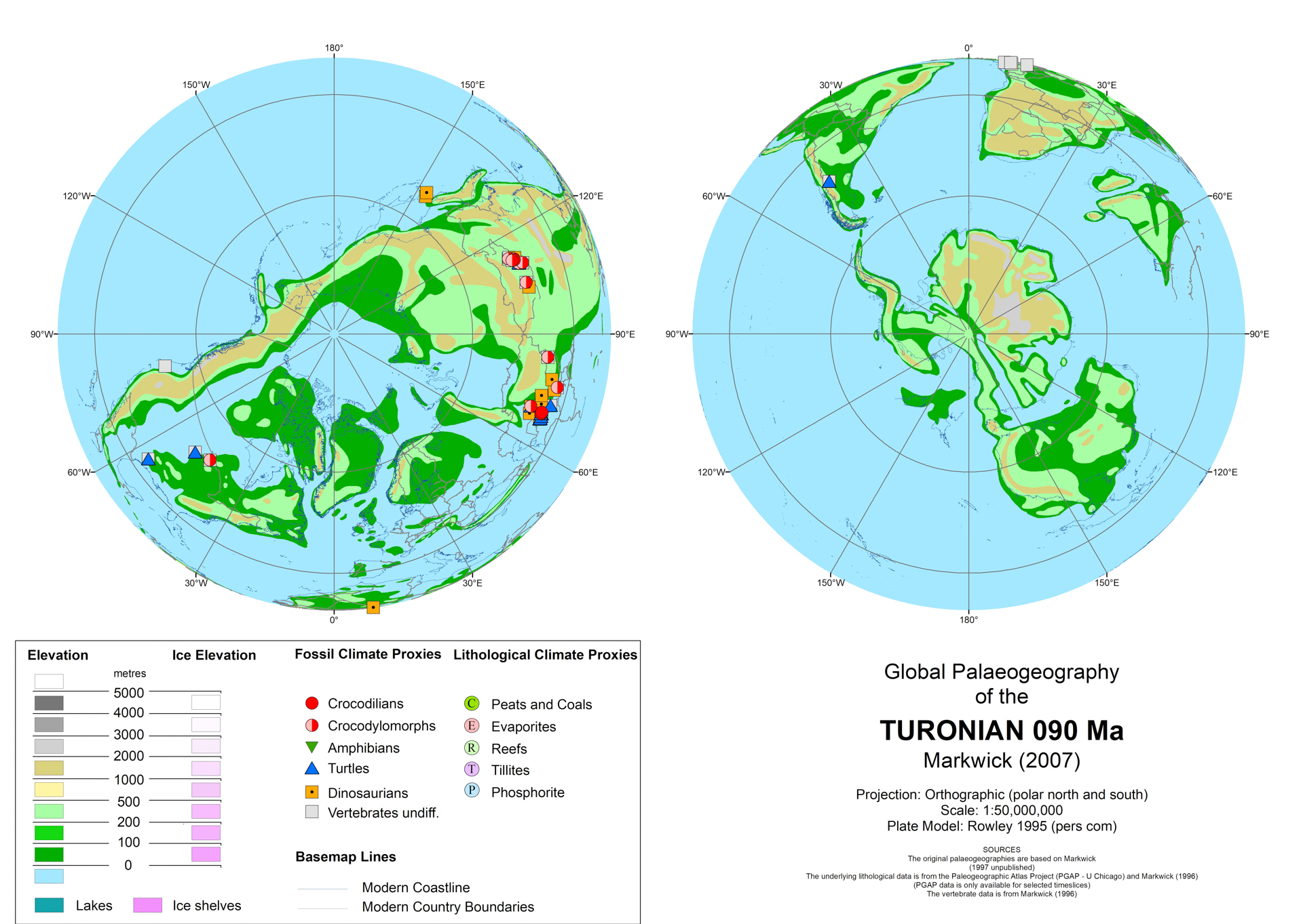
Turonian
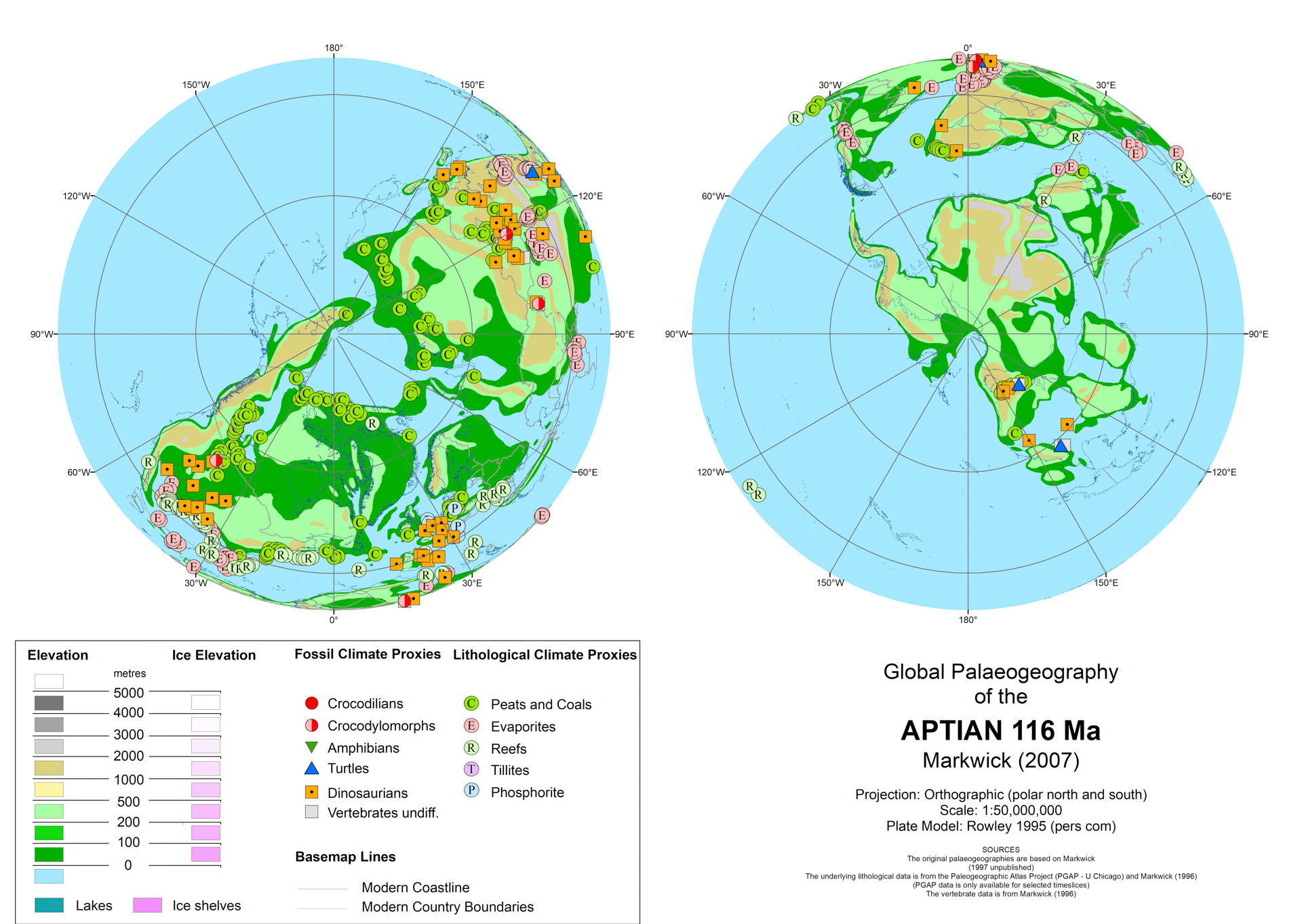
Aptian
|

Santonian
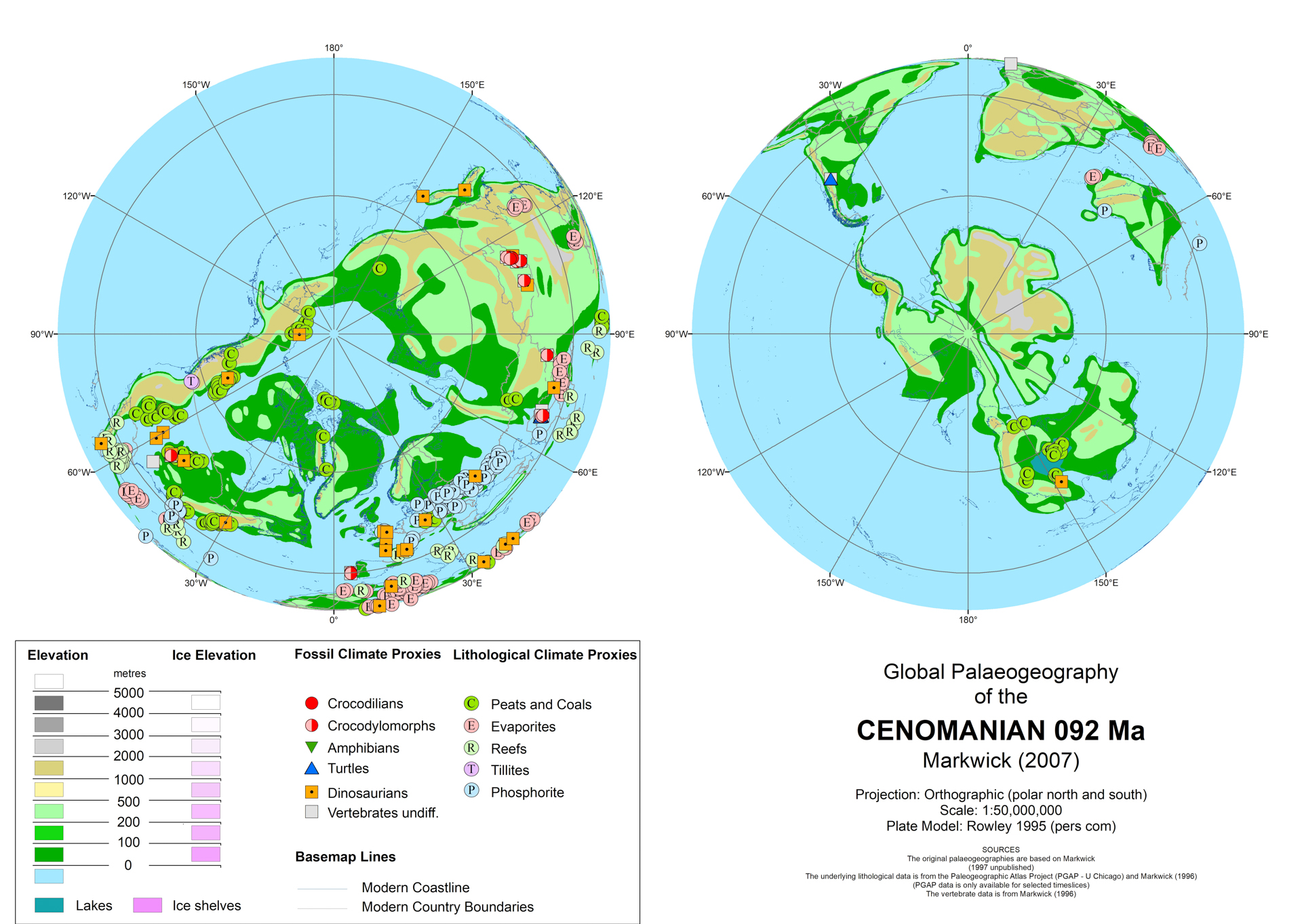
Cenomanian
|
Generation 1 revised Maps
Four timeslice maps were updated for specific coupled ocean-atmosphere modelling, though only the Maastrichtian has been published (Markwick & Valdes, 2004).

|